

If you open up a map-app and locate Valemount, British Columbia, Canada and then start zooming out, you’ll notice that Valemount is located in a clearly-defined valley that runs approsimately northwest to southeast. Keep zooming out and you’ll see how incredibly long this land feature–the Rocky Mountain Trench–is, running about 1,000 miles (1,600 kilometers) from Flathead Lake in the US state of Montana in the south, all the way almost to the Yukon territory in the far north of BC.
Other names include the evocative Valley of a Thousand Peaks and the simple, ominous Trench. On a North (is up) Orientation map, the mountains to the right/east of the Trench are the Rockies, while to the left/west are the Columbia Mountains in the south, and the Cassiar Mountains in the north.
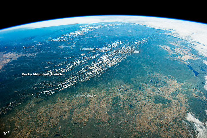
With a width of only twenty-five miles or less, the Trench was mostly created by geologic faulting, though glaciers do deserve a small percentage of the credit. The northern part remains less-developed and accessible than the southern part, most of which has central highway access and more human population centers.
📍Header Photograph: “The Western Edge of the Canadian Rockies”, taken by author Shawn, shows a view looking at the Rocky Mountain Trench extending northwest, from over the area of Kinbasket Lake.
Have a nice Thursday!