
This series previously jumped from Algeria to Andorra, but on looking at a different list specialized to elevation extremes, I decide that it was worth including American Samoa, which though a territory of the United States, has a somewhat unusual status distinct from a state. And simply speaking in terms of geography, it’s a breathtaking place.
Anyway, the highest point in American Samoa is 3,170 ft (966.2 m) Lata Mountain on Taʻū, easternmost of the five inhabited islands that comprise the territory along with two atolls. Neither Wikipedia nor Google Maps have any obvious photos of the mountain; fortunately Peakbagger’s page features this beauty of a shot:

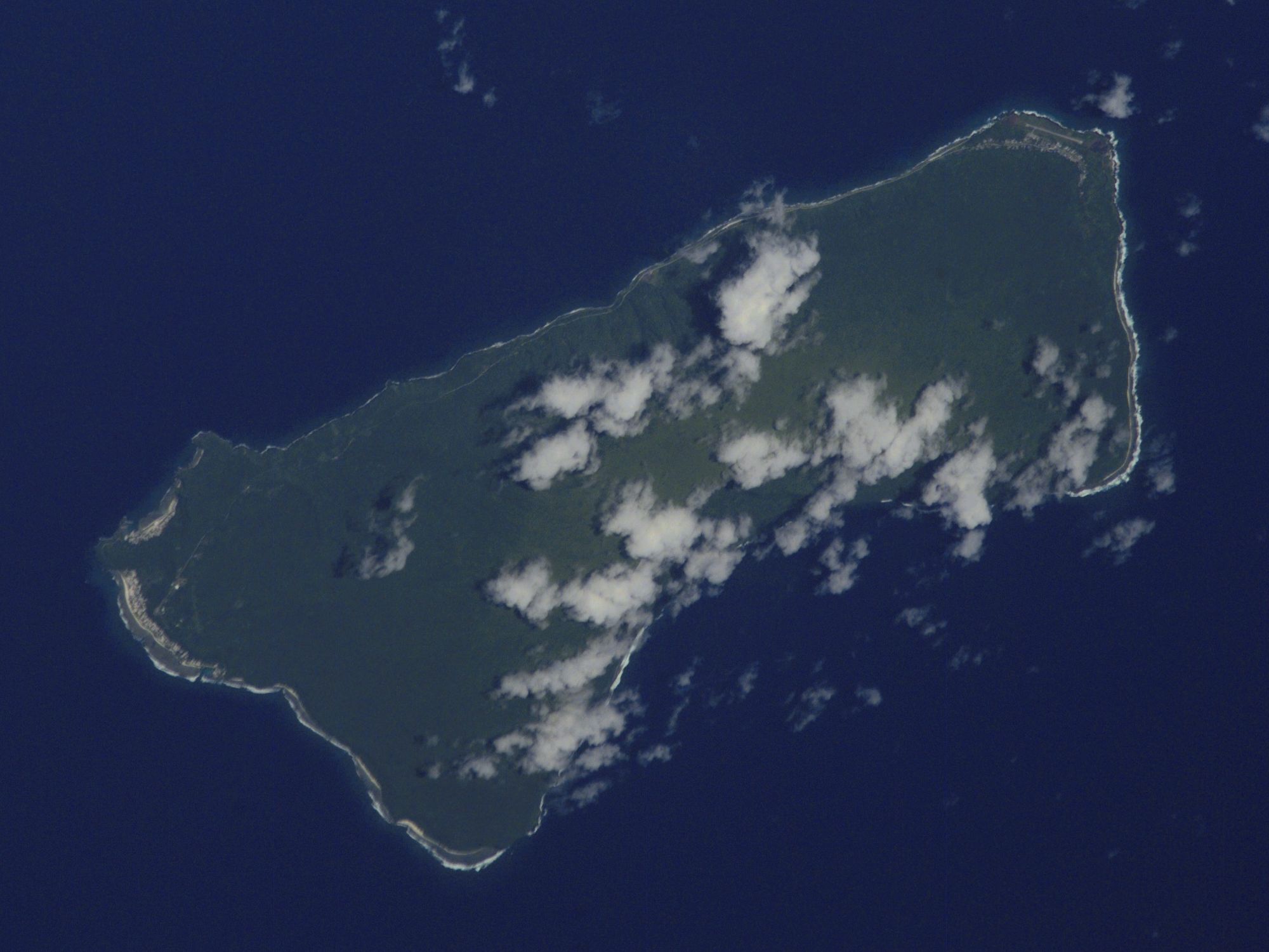
Looking at topographical details on Peakbagger and SummitPost pages, it seems that Lata is located approximately as indicated in this edited Google Maps aerial view, along the crescent-shaped ridge that dominates the island:

The ridge, which I assume is a remnant of an ancient volcanic crater–Taʻū, like many islands in Samoa and the Pacific, is volcanic in origin–may be called Tunoa Ridge. Also of note, the small circular feature that the word “Tau” is superimposed over is called Judds Crater (both of these labels are visible upon zooming closer, but not active, clickable links).
In the process of researching this header, I was frequently astounded by photos of these Samoan islands. Many of them have incredibly dramatic, jagged mountains and ridges rising from the ocean, beautifully covered in dense forests. It’s nice to learn or be reminded of extraordinary places far away from one’s own sphere of familiarity.
Have a good day! 🏞️