


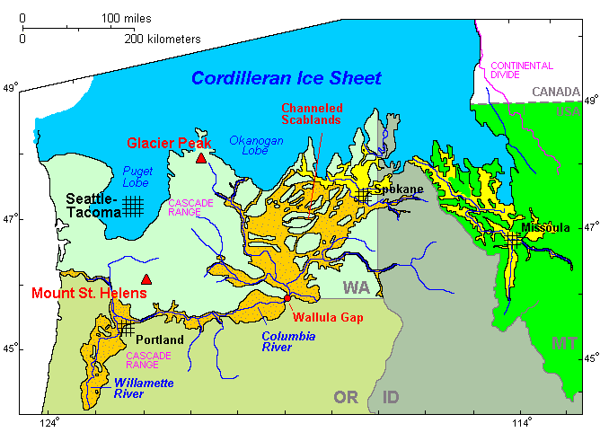
Picture this: A huge lake with fingers winding among the northwestern Rocky Mountains over ten thousand years ago, its waters held in place by an ice dam. The dam breaks and the waters rush westward, eventually following the course of the Columbia River through its gorge and out to the Pacific Ocean. Along the way, the enormous volume floods a significant percentage of what is now eastern Washington state, as well as the Willamette Valley, present-day Oregon’s population center. The waters gradually drain and over the course of decades, the ice dam reforms, starting the cycle over again. These were the Missoula Floods.

This header unfortunately does not have the benefit of enough time to present more information, but this is a fascinating topic to read up on. In addition to the Wikipedia article, here is a broad intro to the topic from the Ice Age Floods Institute. The scale of the Missoula Floods is rather mind-bending.
(The image up at the top is a picture of Drumheller Channels National Natural Landmark, an example of erosive evidence of these events.)
Further down the Floodhole: In some places, these “glacial lake outburst floods” (GLOFs) created mega sand bars/dunes known as Giant Current Ripples.